Hey Algoma, Here We Come!
Editor’s Note: This 8-day Northern Ontario RV Adventure began from Toronto and completed a loop of roadway in Northeastern Ontario and Algoma Country. Click here to read Part 1.
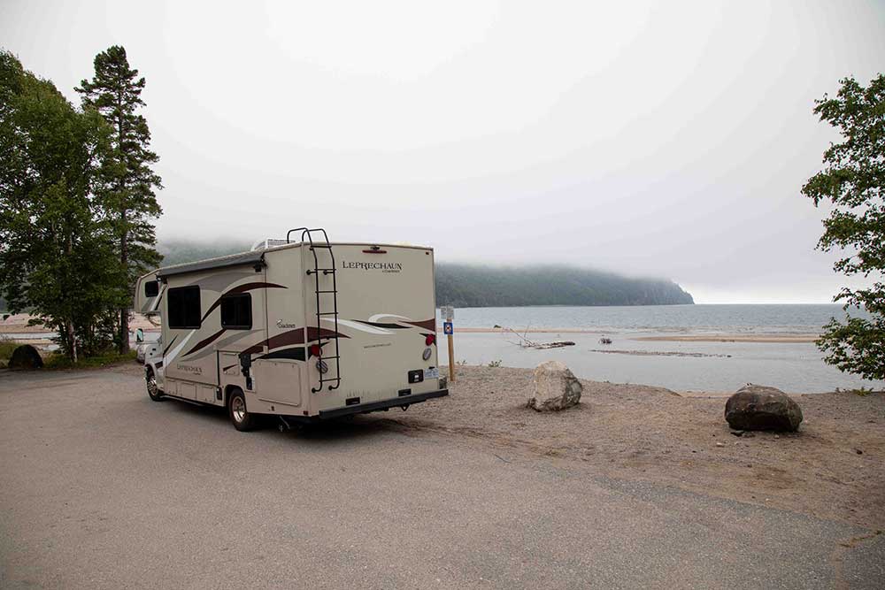
After a relaxing morning at Cameron’s Beach and Campground, we’re ready to roll into day three of our eight-day Northern Ontario adventure. Before making Ontario’s Algoma region our home for the next three days, we have unfinished business here in Northeastern Ontario.
A stop at Timmins Museum National Exhibition Centre proves to be the highlight of the day so far. We browsed exhibits on local history, fantastic art, and the most famous local, Shania Twain. The gift shop is also worth some time; we even spotted some alpaca socks from our Dream Acres Alpaca Farm friends!
Now, we are getting ahead of ourselves. First things first, it’s time to pack up. Did we mention how easy it is to set up the RV at camp? Well, getting ready to move on is just as painless. We love it. The camping chairs are stored in the outside accessible storage, and with the press of a button, the slide and awning are brought in. Then, we disconnect and store the power cable and water hose and are ready to hit the road.
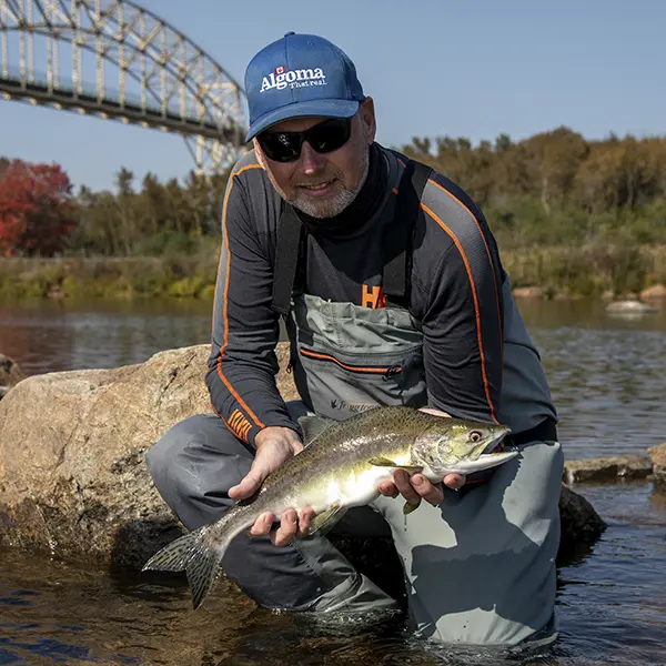
Ok, Algoma, let’s see what you got.
Day 3 – Iroquois Falls to Wawa – 405 km
Hitting the Road to Algoma
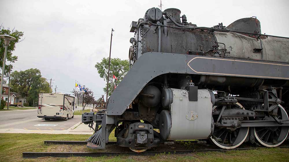
We have the landscape all to ourselves as the kilometres tick away along Highway 101. In Chapleau, we stop by Engine 5433 for a glimpse into the community’s railway heritage. This is also the location for the area’s tourism information office if you need assistance.
A photo op presents itself with the Arctic Watershed sign, and we oblige. The sign marks the spot where, north of here, water drains into Hudson Bay; rivers, lakes and streams to the south flow into the Great Lakes.
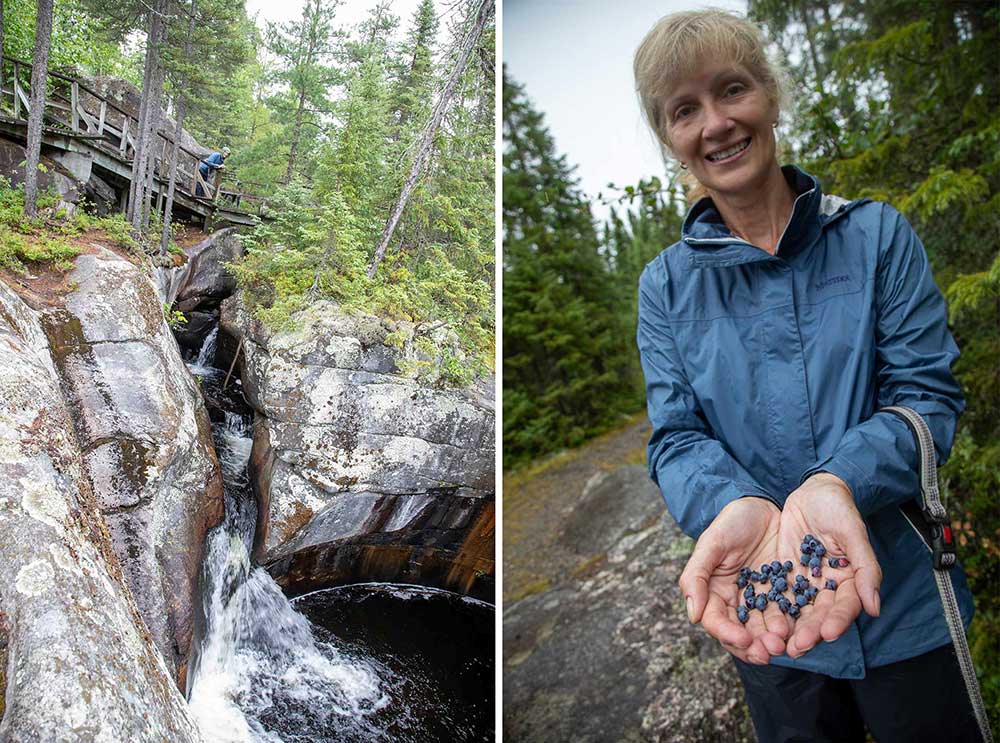
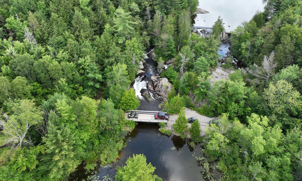
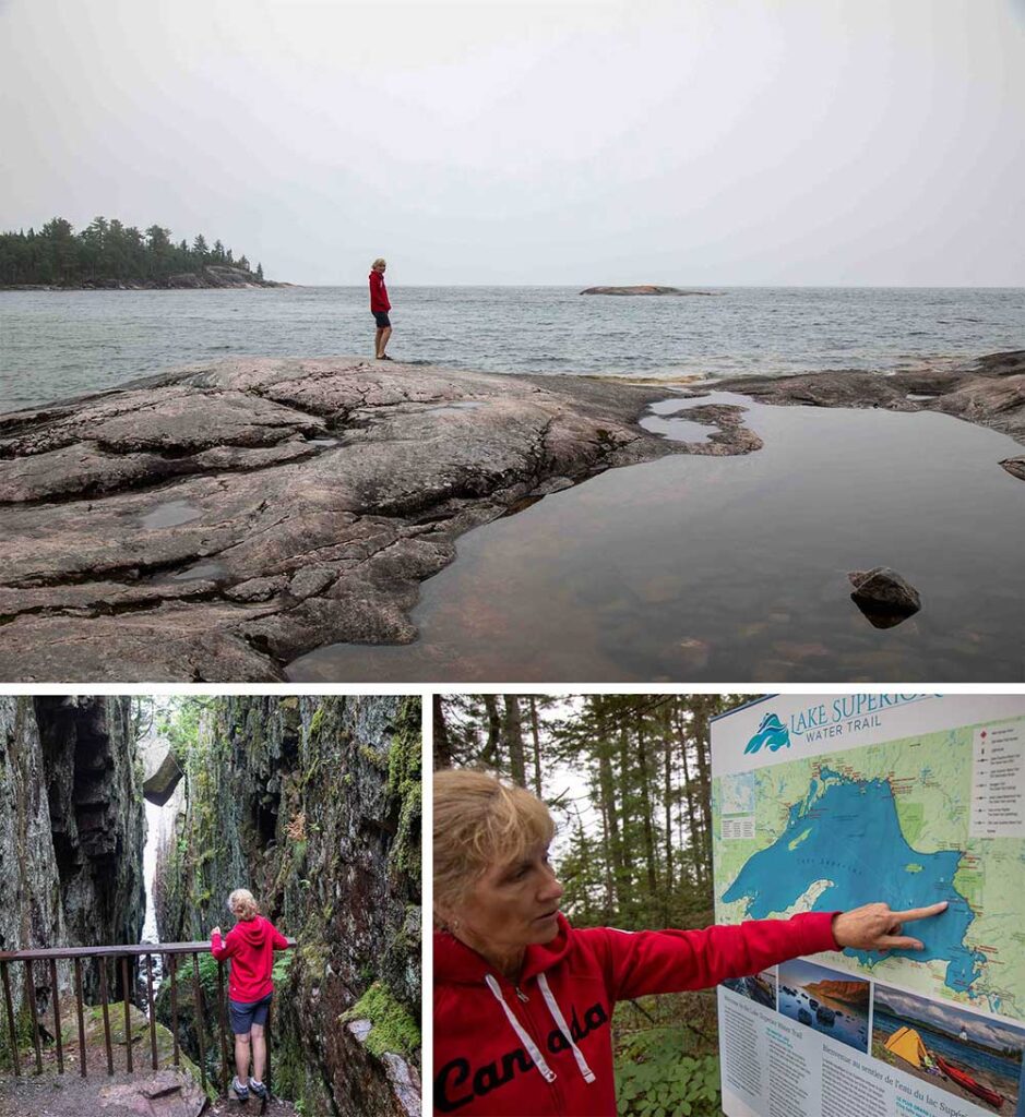
Algoma’s Best-Kept Secret: Potholes Provincial Park
Potholes Provincial Park might be Algoma’s best-kept secret. Even a Google Maps search for directions yields no results. We switch to the old-school navigation skill of keeping an eye out for the sign. Our only company is raindrops as we follow walking trails and boardwalks, study interpretive signs, and take in distinctive bedrock scenery along the Kinniwabi River, including “potholes” formed by glacial erosion, miniature waterfalls, and a boreal forest. An unexpected bonus: blueberries and lots of them. We are happy to pick our fill.
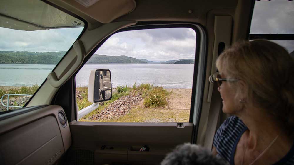
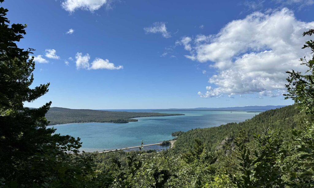
The rolling landscape along Highway 101 is replaced by towering roadside rock cliffs and glimpses of Wawa Lake, announcing our soon arrival in Wawa. We park by the beach along Wawa Lake, have lunch, and enjoy the spectacular view. If you want breakfast, lunch, or dinner in Wawa, we recommend North of 17 Restaurant, which is excellent. Young’s General Store is the place for a snack or ice cream, and for travel information and a chance to meet the world’s largest Canada Goose, the Wawa Visitor Centre is a must-stop.
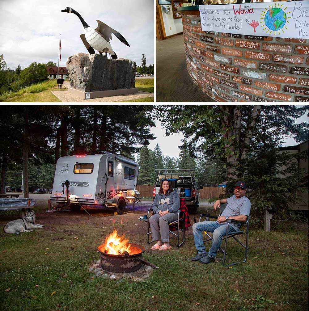
We set up for the night at Wawa RV Resort & Campground. Wawa RV Resort marks our furthest west progress. Tomorrow, we start our journey home, in no hurry, of course. Like so often happens, tonight’s camping neighbours are now our new camping friends, and the evening is spent by the campfire sharing stories of adventures past.
Day 4 – Wawa to Sault Ste. Marie – 215 km
The Journey’s Highlight: Lake Superior’s Scenic Drive
When planning a road trip of any length, the overall plan is usually built around something: a destination, an experience, or maybe a location. Today’s itinerary is the foundation of this adventure through northern Ontario. Today’s drive from Wawa to Sault Ste. Marie is considered one of the best drives in Canada, and we can’t wait to experience it. Add to that many opportunities along the way to stop and take in the spectacle that is Lake Superior, and yes, we are excited.
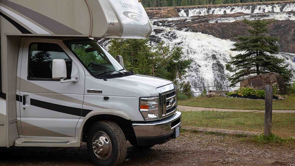
Never one to pass up a chance to check out a waterfall, we follow the signs to Scenic High Falls, just minutes from Wawa. The waterfall was awe-inspiring, the washboard of a gravel road coming and going, oh boy.
Lake Superior Provincial Park Wonders
We are on our way to Lake Superior Provincial Park and driving east along the Trans-Canada Highway 17. The road drops away, and we are greeted with the stunning view of water, sand, and the towering cliffs of Old Woman Bay. It’s truly amazing.
We found a parking spot right along the beach and decided to take a break. It’s safe to say we stayed for a while, enjoying the gorgeous scenery.
Rolling through Lake Superior Provincial Park, we stopped at Katherine Cove, the Agawa Bay Lookout, and the visitor centre and took a short hike. We spent some time shopping at Agawa Crafts and the Canadian Carver. Then, we stopped by The Voyageurs’ Lodge to grab a snack and gas for the RV. Although The Voyageurs’ Lodge is known for their mouth-watering apple fritters, we were disappointed to find out that they were already sold out for the day.
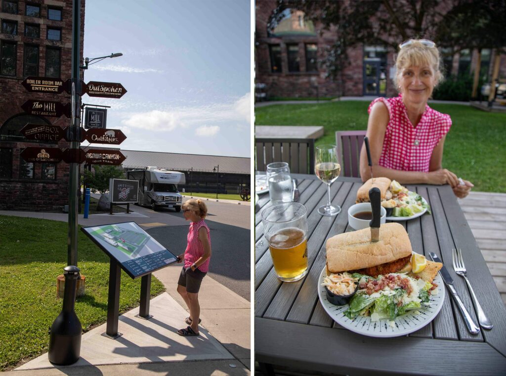
It’s not over till it is over; there is more to discover in Sault Ste. Marie. We make our way to the Canal District, where we watch boats navigate the Soo Locks, hike to the edge of the St. Marys River and enjoy a delicious dinner at The Mill Steakhouse.
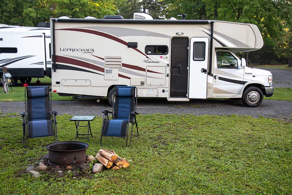
We overnight at Glenview Cottages and Campground, ideally located along Highway 17 at the edge of Sault Ste. Marie.
Day 5 – Sault Ste. Marie to Elliot Lake – 217 km
While day four was all about Lake Superior, today, the water theme continues as we make our way east, town hoping along the Lake Huron North Channel. As days go by, this one is shaping up to be a busy one.
Roadside Gems & Unique Stops
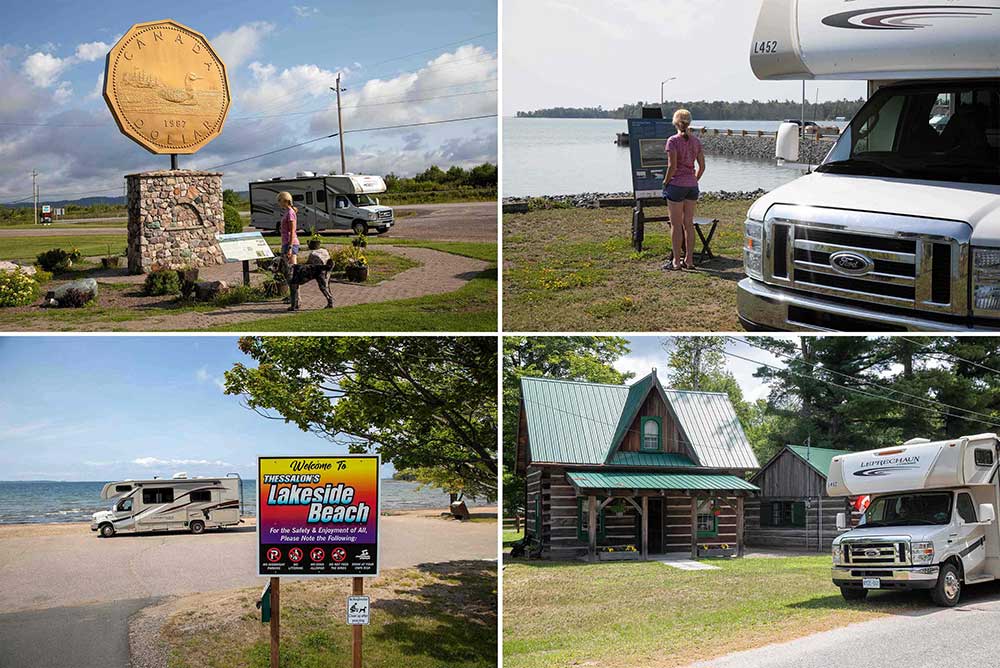
- First stop, Echo Bay and the Giant Loonie, photo op? You bet. You can find the monument along Highway 17B in the Village of Echo Bay, a short detour from Highway 17. The structure was constructed in 1992 and is a dedication to Mr. Robert R. Carmichael, the artist responsible for creating the Loon Dollar design and a Township resident.
- In Bruce Mines, we stop at the marina and the Moments of Algoma Panel that marks the spot where Tom Thomson painted the town’s waterfront.
- In Thessalon, we pass by the Red Bridge across the Thessalon River. The bridge was initially built of wood in the late 1880s, but has been updated to steel since. Why did the RV cross the bridge? To get to the beach, of course, and Thessalon’s Lakeside Beach is spectacular and definitely worth the slight detour.
- In Iron Bridge, the Iron Bridge Museum showcases the area’s history. The log cabin, now the Main Museum Building, dates back to 1879 and contains many artifacts used by farmers and loggers in the area.
- In Blind River, we grab lunch at Pier 17, then head over to the Blind River Marina to check out the Timber Village Museum and the art gallery.
- We walk to the Kennebec Falls at Serpent River Parkette. This is one of our favourite rest stops, nestled amongst towering pine trees.
- The final stop is at the Deer Trail Centre before turning towards Elliot Lake.
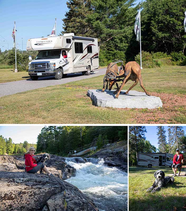
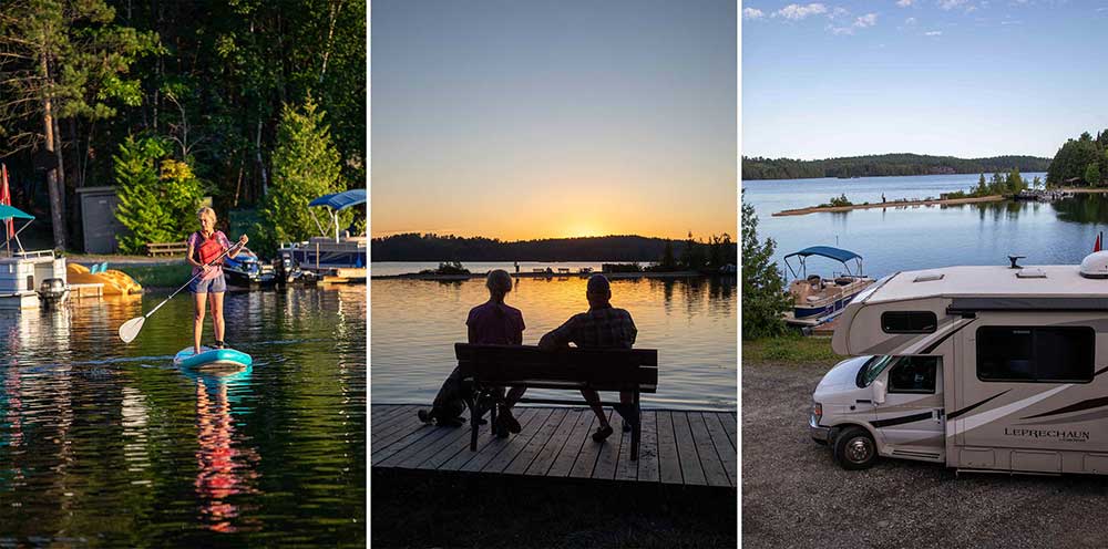
We end the day at South Bay Park along the shore of Dunlop Lake, 10 kilometres north of Elliot Lake, where we enjoy swimming, paddleboarding, and watching the best sunset of the trip.
Thanks for the memories, Algoma. We wish we had more time, but the show must go on.
Next up: the largest freshwater island in the world. Click here to read Part 3!
Tags
About the Author
Martin Lortz is a freelance photographer/writer specializing in the outdoor lifestyle.