A Road Tour of the Island
Are you a history buff and enjoy beautiful countryside drives? Do you enjoy quaint places to eat and stay? Do you love the outdoors to walk or cycle? Well, the St. Joseph Island Historical Signage Tour is for you! It is also a wonderful physical distancing activity for you and your family! St. Joseph Island has deep historical roots. Richards Landing and Hilton Beach are the two communities on the island.
Beautiful St. Joseph Island is approximately 50 minutes or 67 km east of Sault Ste. Marie, Ontario along the Trans-Canada Highway 17 East.
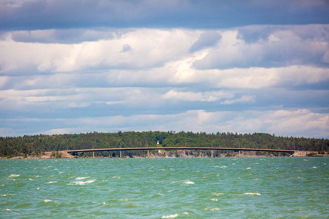
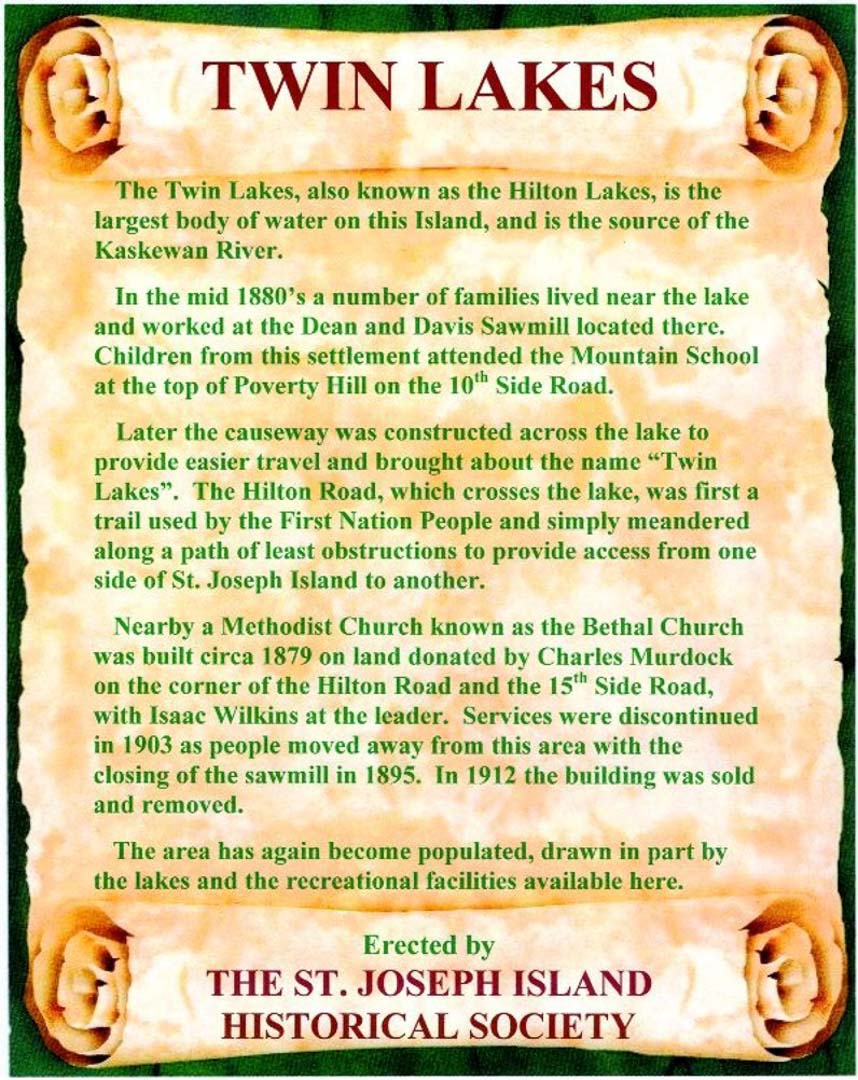
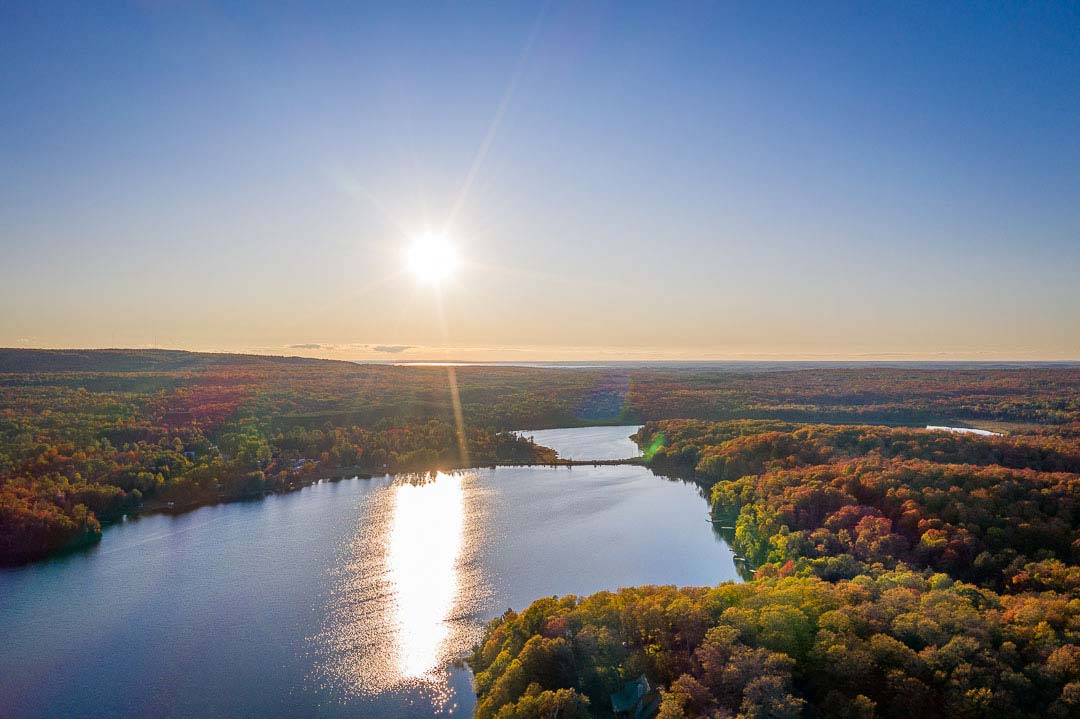
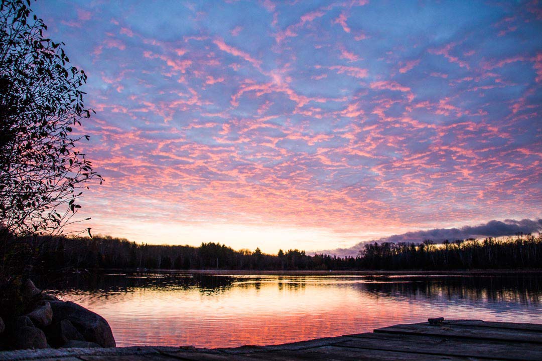
Every time I begin to cross the beautiful bridge, I breathe such a wonderful relaxing breath. The Island is our getaway as we have a cottage here. Sign #23 Twin Lakes is our happy place!
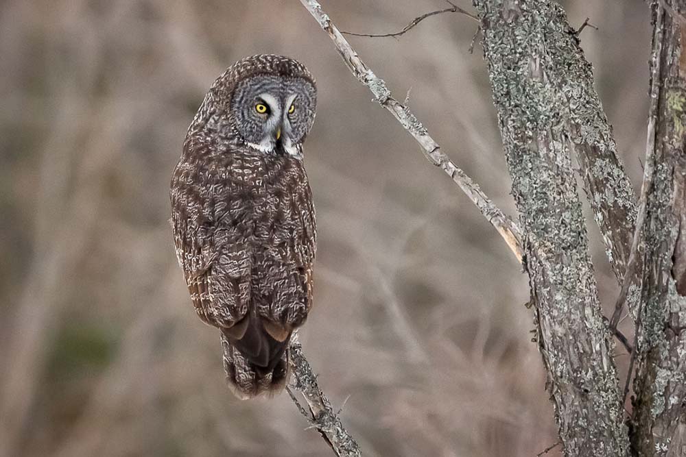
As a freelance photographer and writer, I am almost daily touring around the island photographing the wildlife, landscapes and amazing night skies. In my travels, I noticed the SJIHS signage around the island. The history of each is quite fascinating. I often photograph the areas the signage is in.
The signs intrigued me so much that I looked up The St. Joseph Island Historical Society (SJIHS) online and contacted Webmaster Bernie Crosby. Bernie was very helpful with the events leading up to this historical project coming to fruition to preserve the history of the island. Initially, various fundraisers began to finance the project such as book sales, calendars, notepad and general donations.
Bernie said that in the first year, 2004, ten signs were obtained and put up. The next year, the SJI Historical Society obtained a grant and the next 20 signs were added. Each sign costs more than $100.00 and the refurbishing costs approximately $35.00 for each using the existing sign. All of the signs currently have been refurbished and are constantly being inspected. They have had assistance from each township for signs in their area.
The SJIHS hopes to get GPS locations on each of the signs and update the map to show this as well as the distance between signs to better promote them to walkers, bikers, etc. Lastly, Bernie said they have their original list of sites identified as historically significant to St Joe’s history. The SJIHS still has 55 signs to go!
All of the work on this project has been done by the members of the Historical Society. The executive members are President: Will Clarke, Vice-President: Alice Ward, Secretary: Bernie Crosby and Treasurer: Steve Frech. Barb Davies, their historian has since passed away. The St. Joseph Island Historical Society (SJIHS) is a self-supporting organization with the mandate to research, record, and preserve the history of St. Joseph Island. The St. Joseph Island Historical Society was originally formed as part of a LACAC (Local Architectural Conservation Advisory Committee) and later was set up as a separate organization. SJIHS is a member of the Ontario Historical Society.
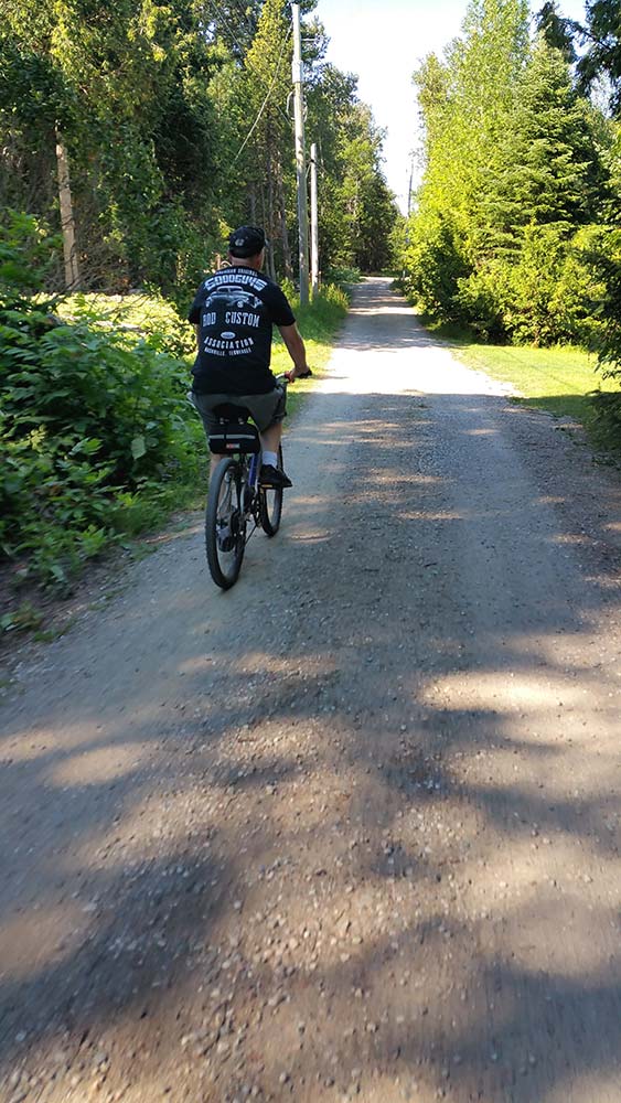
The St. Joseph Island Historical Society (SJIHS) welcomes everyone to come out and enjoy a day of exploration or stay at one of the hotels, cabins or B & B’s for a weekend. You can tour the island by car; or bicycle or you can plan walking excursions to enjoy the many historical sites available on beautiful St. Joseph Island! You can find a great guide to cycling St. Joseph Island here.
To start the self-guided tour, you need to download the map with all thirty sites posted and the signage list. The map can be found online.
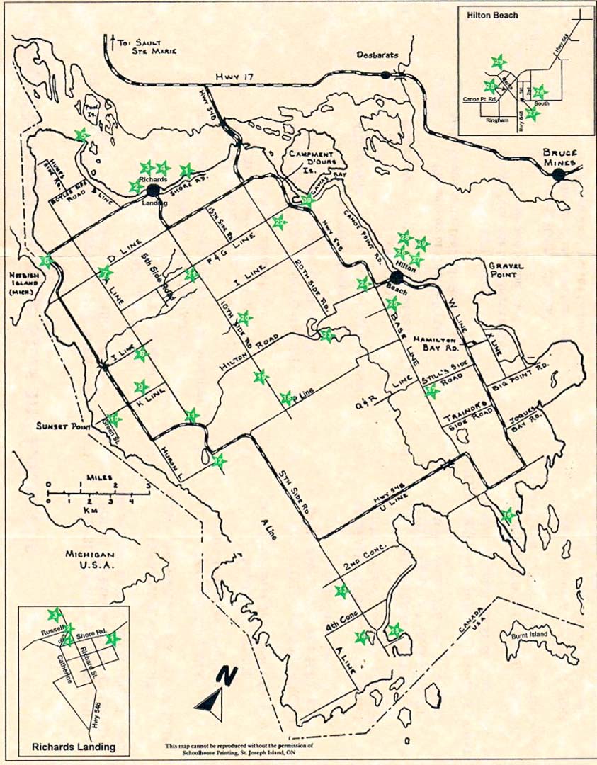

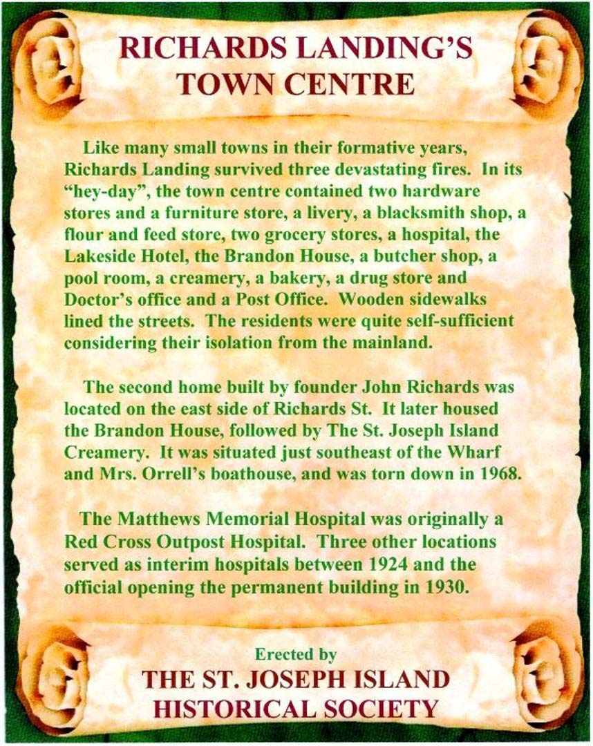
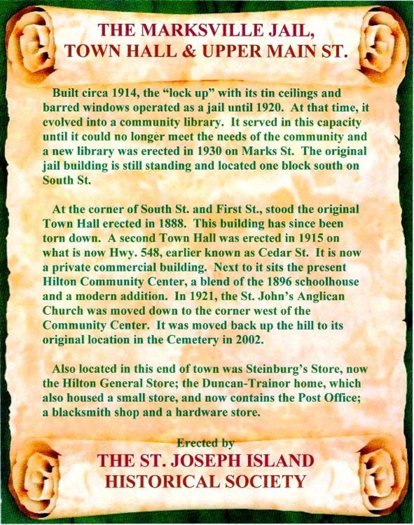
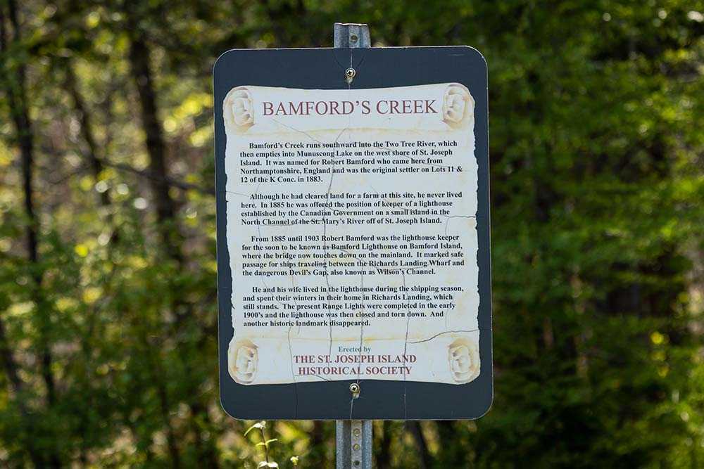
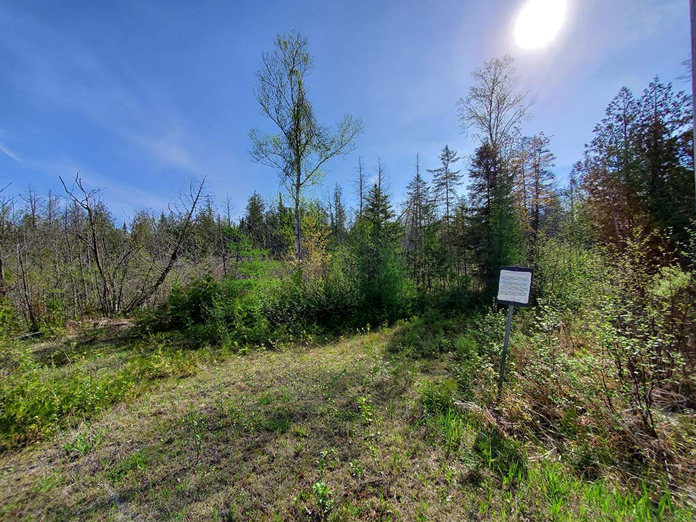
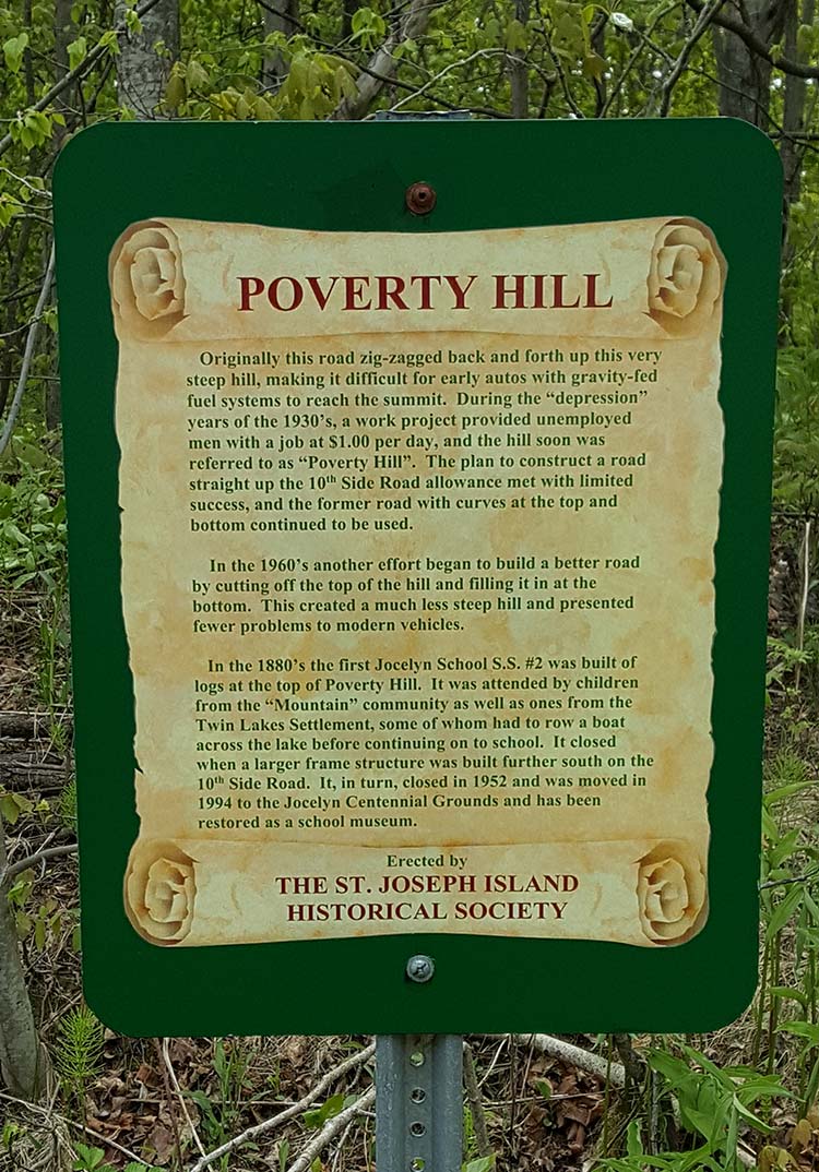
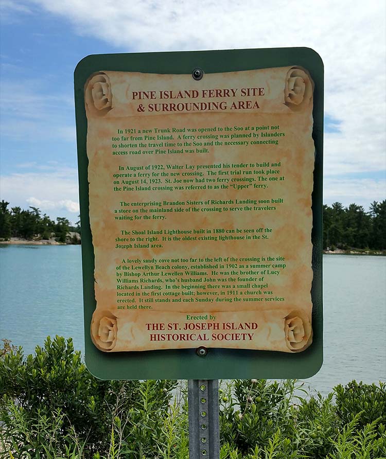
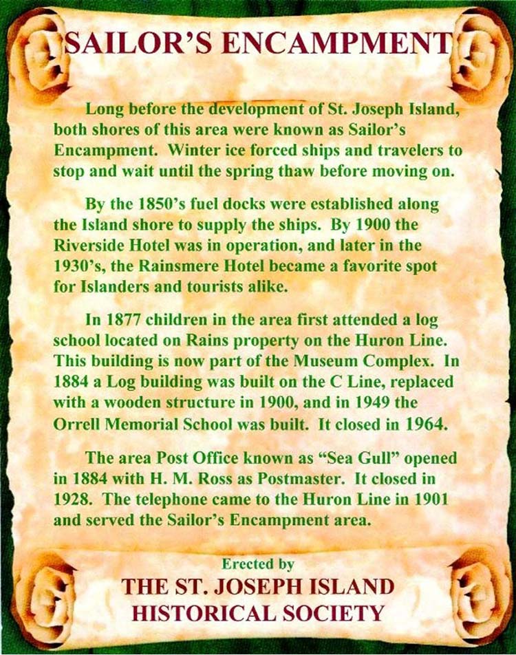
As you drive to the locations on the map, look for the historical signs that are posted. Each sign is a forest green colour with a historical scroll on it. The top of the scroll has the name of the historical site and the bottom of the scroll says: Erected by The St. Joseph Island Historical Society. The middle of the scroll has the historical significance of each site.
Here are just three examples from my touring around St. Joseph Island and some photography along the way:
Sign #5 Pine Island Ferry Site & Surrounding Area off the end of B Line. I just love the Shoal Island Lighthouse at this location! There is also a boat launch here if you wish to kayak, canoe or go fishing.

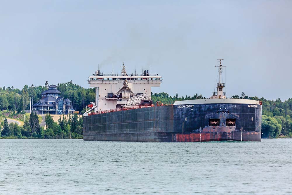
Sign #6 Sailor’s Encampment is a wonderful area to watch the big freighters sail through a very narrow passage between Canada and the USA! It is also a beautiful area for magnificent sunsets.
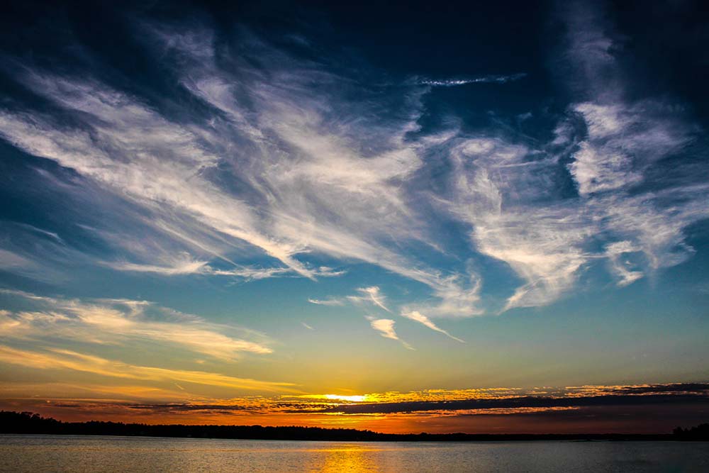
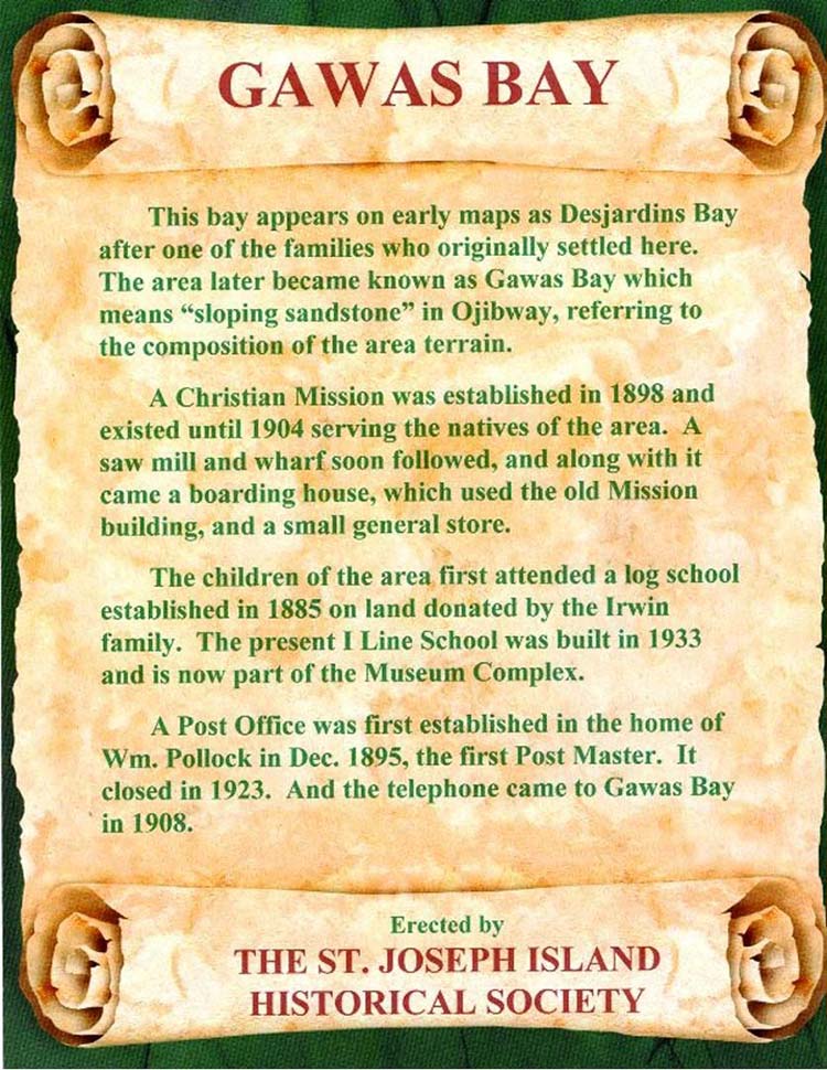
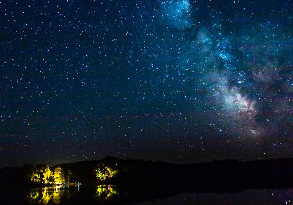
Sign #30 Gawas Bay is a favourite of mine as it has it all. It is a very popular spot to launch your fishing boat, canoe or kayak. It is also full of wildlife and has amazing night skies!
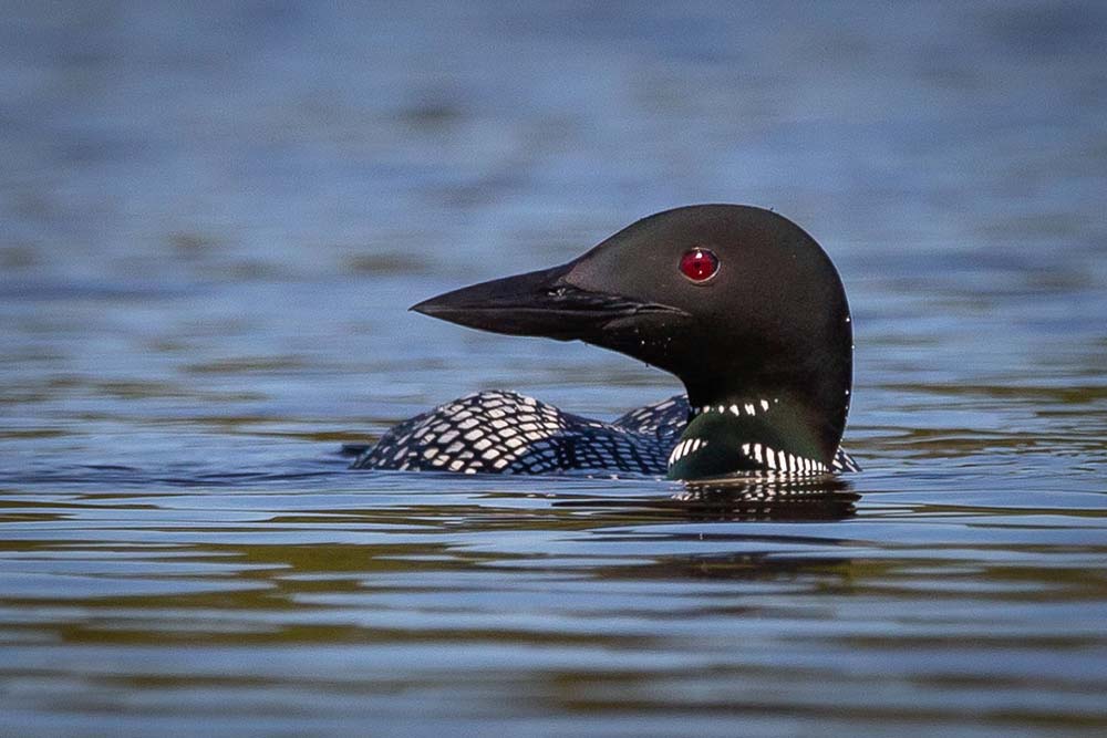
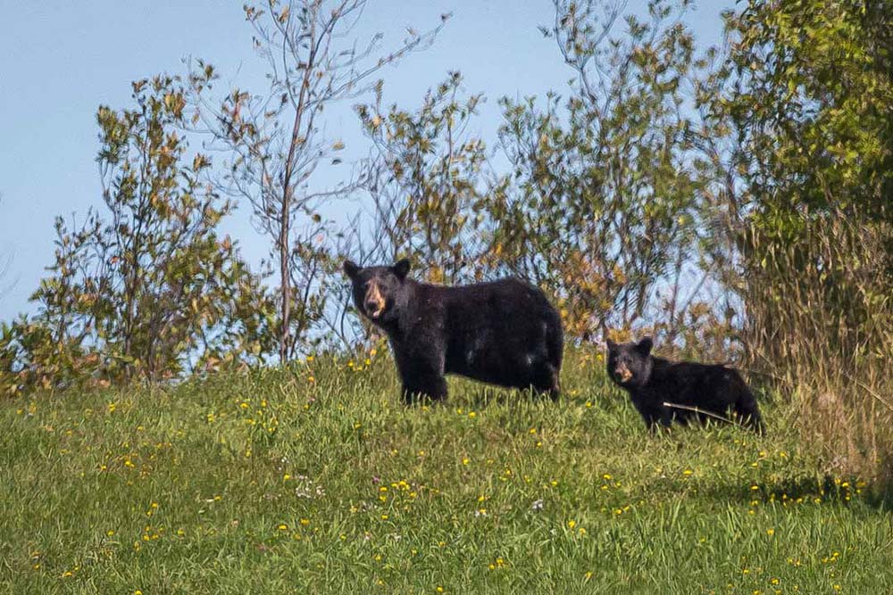

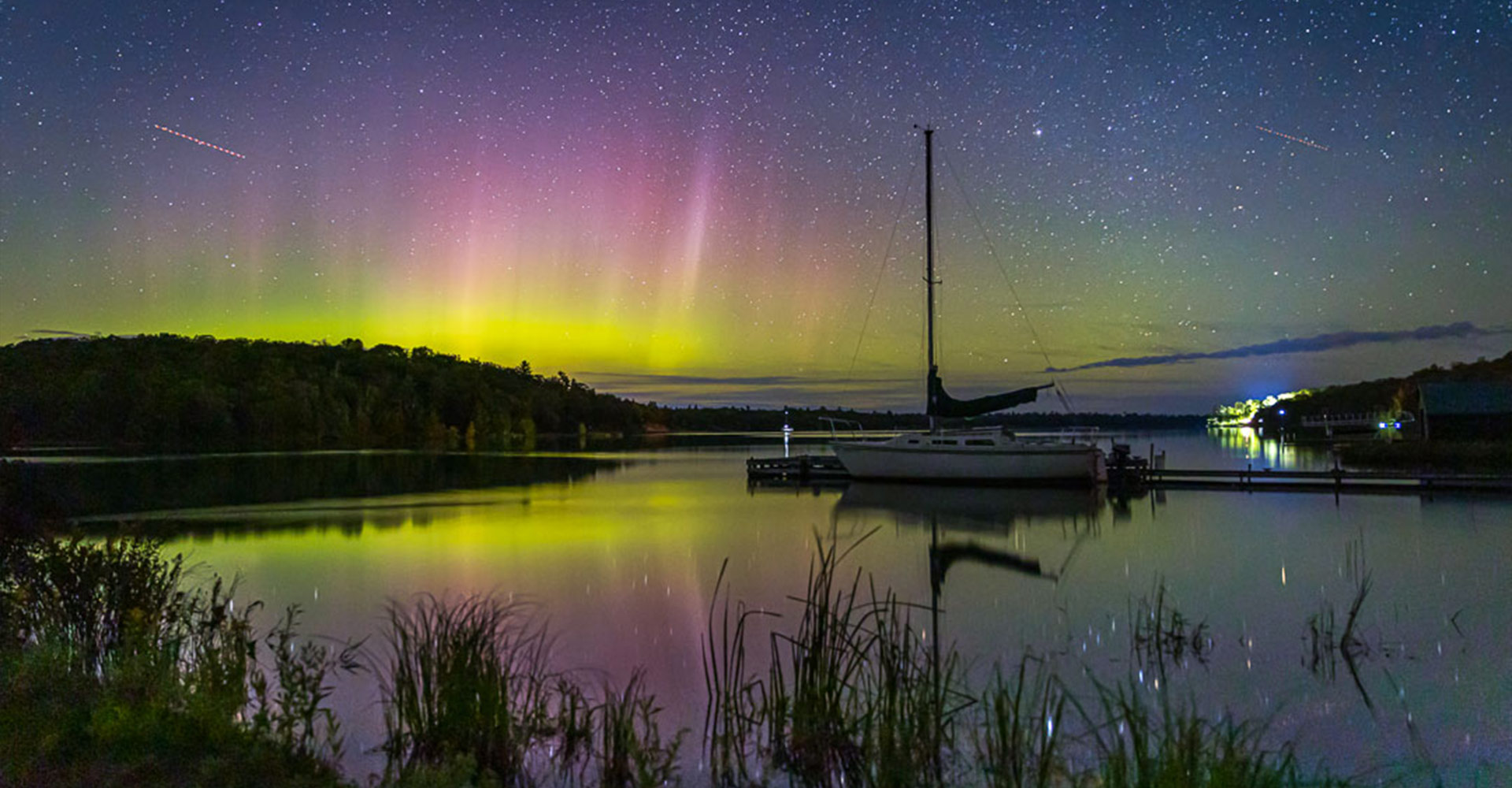
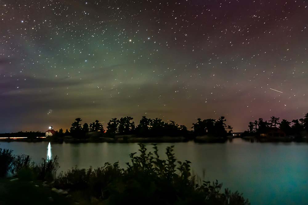
As you travel around the island, you will come across all kinds of beautiful birds, wildlife and amazing landscapes. The night skies are also spectacular to see comets, the Aurora Borealis and the Milky Way when the conditions are just right!


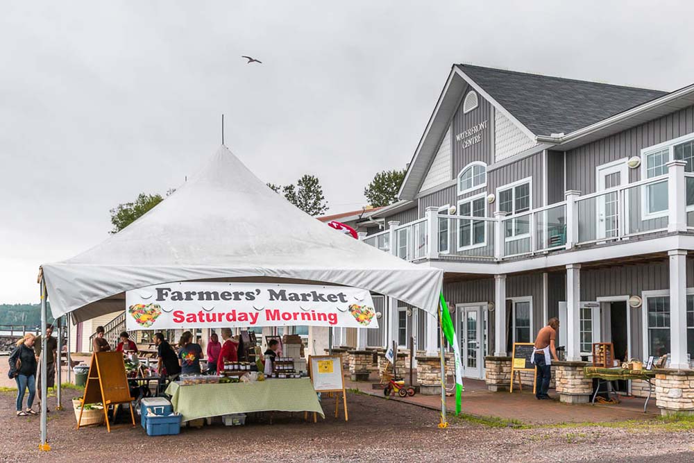
This wonderful historical tour has something for everyone. Thank you to the St, Joseph Island Historical Society for all of their hard work on this project! The island hospitality is a wonderful experience whether you come for the day or an extended stay. As you travel the tour, don’t forget to shop and eat along the way!
Places To Eat
You will also need a map of the Island to help you find places to stay and eat.
- Tilt’n Hilton Steakhouse and Bev. Co
- MadJacks Cafe (seasonal)
- Whiskey Rocks (seasonal)
- Black Bear Cafe
- Stub-bees Bee-stro
Places To Stay
- Whiskey Bay Resort and Marina – RV and Cabins
- Fred’s Trailer Park
- Busy Beaver Campground
- Hilton Beach Tourist Park
- Sunnyside Bed and Breakfast
- Maria’s Cabin
Historial Resources
About Sheri Minardi
Born and raised in Sault Ste. Marie, Sheri Minardi is a retired teacher from the Algoma District School Board. Along with the love of teaching, Sheri has a passion for photography. Sheri Minardi Photography captures the magnificent Algoma region through her lens. She loves to set out on adventures to capture Wildlife, Landscape and Still Life.
Related Posts

A Hidden Gems Algoma Road Trip
When the air gets crisp and the leaves begin to change to shades of red,...
Read More
A Guide To Snowmobiling In Algoma
Are you ready to carve your path across a pristine winter landscape and...
Read More
A Guide To Camping In Algoma Country
Are you an avid camper seeking a new adventure, or a first-time camper?...
Read More